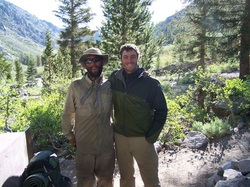
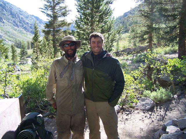
 Histo-Karl hiked mostly alone from Onion Valley to Mammoth, entering Mammoth via Ducks Pass and Lake Mary rather than Reds Meadows, on June 24. He spent a relaxing day in Mammoth and headed for Tuolumne Meadows, the end of the JMT for PCT thru hikers (unless they take a side trip to the Valley). He arrived in Tuolumne June 27, picked up his huge box of resupplies, spent the night, and is leaving this afternoon (Thursday, June 28) with Spud and Snausage (see Snausage in the photo at the left with Histo). It's 105 miles to Ebbetts Pass, but Karl will turn off about 6 miles before the pass to go to Highland Lakes to meet Mom and Lena for the 4th of July. Then it will be on toward Tahoe. The hat in the photo below is a goner, so he'll be sporting a wide-brim one in future pics. Happy trails, Karl!
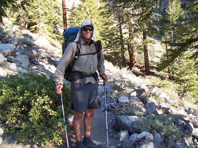
From Kennedy Meadows Nips, Wildflower, Snausage and I headed out into the High Sierra. The hiking at altitude with Bear Cans full of food made the miles go slowly. But the vast landscapes and mild temperatures made it all enjoyable. We spent a night at our first high alpine lake, Chicken Spring Lake at 11,200 feet. The following morning I pushed ahead of the group a bit, eager to get to Crabtree Meadow, my base camp for climbing Mt Whitney.
Though I’ve been up Mt. Whitney (14, 505’) twice before, I was excited for a new challenge. Just before midnight that morning seven of us: Weebee, Blackbeard, Destroyer, Pounce, Lotus, Old Spice and I set out, headlamps ablaze to make the summit by sunrise. By 5 am we were on the summit, and soon in all our clothing and our sleeping bags we watched the magnificent golden hour light and the orange disk peek out over the mountains beyond the Owens Valley. The lack of sleep was worth it. The cold was worth it. It was a spectacular sunrise. Lotus and Old Spice got engaged on the summit; congratulations to you guys!
The following day the trail, now the John Muir Trail through the High Sierra, carried us up to Forrester Pass. At 13, 180 feet it is the highest point on the PCT. The guidebook says we “now begin our net 9000’ descent to Canada.” Looking out into the High Sierra from atop these high points is incredible, especially this year, which is very very dry. Last year the thru-hikers had to travel on snow for over 400 miles. We won’t have 400 feet.
I hiked out over Kearsarge Pass to the Onion Valley campground to meet my mom and resupply. Seeing my mom as I was heading down the trail was magical. After 53 days on the PCT it is hard to keep track of time; it certainly doesn’t feel like it’s been very long, but being with my mom, the constant in my life, helped me realize that I’ve grown as a person from this experience, and that I know myself a little better.
Now the team, Team Straight Edge as we are jokingly called, is split up. We all have different resupply strategies for the Sierra. But that is life on the trail. I will hike with other amazing people and on my own, just enjoying the magnificence of the mountains and the ease of the low snow year.
On a side note: I spent several months dehydrating dinners for the trail. It was tons of work but almost everything I made has been delicious and creates jealousy among other hikers eating ramen or Knorr sides; it was totally worth it!
Second side note: Thank you to everyone who makes comments on the website, or who sends me snail mail. It means a lot to hear from friends and family at home. Thanks Andrea for the awesome granola I’m eating along the way.
Mom’s report from Onion Valley:
I spent three days hiking part-way up Kearsarge Pass getting acclimated, chatting with campers, thru-hikers and trail angels (Bristle Cone and Uber Bitch, who are hosting hikers at Onion Valley for about three weeks this season). I met Histo (Karl) coming down the trail from Kearsarge Pass. What a thrill!
I got to meet Peels as she passed through on her way to town, and Snausage cooked tasty burritos from food I brought. He, Histo and I enjoyed a great dinner and evening. Snausage camped with us and headed back to the trail Monday, while Histo took a zero day while I hiked to pretty little Robinson Lake (no switch-backs, straight up 1500 feet in a mile-and-a-half, just because)!
It was great to see that Karl is healthy and happy, and has already accomplished a challenge beyond my and many others’ abilities. I got a first-hand look at many thru-hikers (including Chris from Kalamazoo, Thor, Desert Fox, Creep, Threshold, Data, Peanut, Brian from Sacramento, Mad Dog Murph, Nugio, Rapunzel, and Last on the Bus); met hikers’ friends or family who were backpacking with giant packs to take their resupplies over the pass.
Tuesday June 19 I walked with Karl a little ways up the trail and waved him on his way, while I headed to the car for a 7-hour drive home. I would have rather been hiking! We’ll hear from Histo again from Mammoth, then Tuolumne Meadows. His sister Lena and I will meet him for the 4th of July at Ebbetts Pass.
Check out TWO new albums: Kennedy Meadows, which has the pictures from the previous post (Agua Dulce to Kennedy Meadows), and the newest, Onion Valley, with photos from Kennedy Meadows onward.
Southern California has been hot and dry. We have carried water for 25 mile stretches and been saved by water caches, and lucky cool weather at times. Now after 700 miles I have made it to a landmark I have been dreaming of since reading trail journals over the last two years: Kennedy Meadows. This small town has everything a hiker needs: a general store with a big porch and a trail angel. This cybercafe runs on solar power!
From here the trail climbs into the High Sierra, where even in this low snow year there is water everywhere. Between Walker Pass, HWY 178, there is not another road that crosses the Sierra until Tuolumne Meadows, almost 300 miles. This section follows the John Muir trail and is considered some of the most spectacular terrain on the trail. It is somewhat surreal to be here, done with Southern California, with less than 2000 miles left to hike.
Here in Kennedy Meadows hikers pick up bear resistant canisters as they head into bear country. Though the night before rolling in (which was the first night in 44 days on the trail that I chose to sleep alone, for those concerned about loneliness.), was my first bear encounter on the trip. A juvenile black bear was sniffing around my campsite around 1am. It seemed the bear had been heading down the trail to check out an overused campsite near Fox Mill spring and smelled me. I had not cooked or eaten dinner there. I scared it away, but didn't get much sleep after that.
The last stretch out of Tehachapi was a tough seven days. I did not get my new shoes as planned and did a painful 140 extra miles on my worn out trail runners. But thanks to family and friends of my hiking buddies we got extra love that made the stretch amazing. Bill and Phyllis met us at Walker pass and whipped up a huge salad and brought beer and snacks. These guys know what hikers need. Bill, who is now 78, thru-hiked the trail in 2001, and his wife Phyllis road tripped between the trailheads meeting him along the way.
Then in Kennedy Meadows Wildflower's parents cooked us an amazing dinner and brought beer, and baked goods from the Buttery in Santa Cruz. I have been humbled by the generosity I have encountered along this trail.
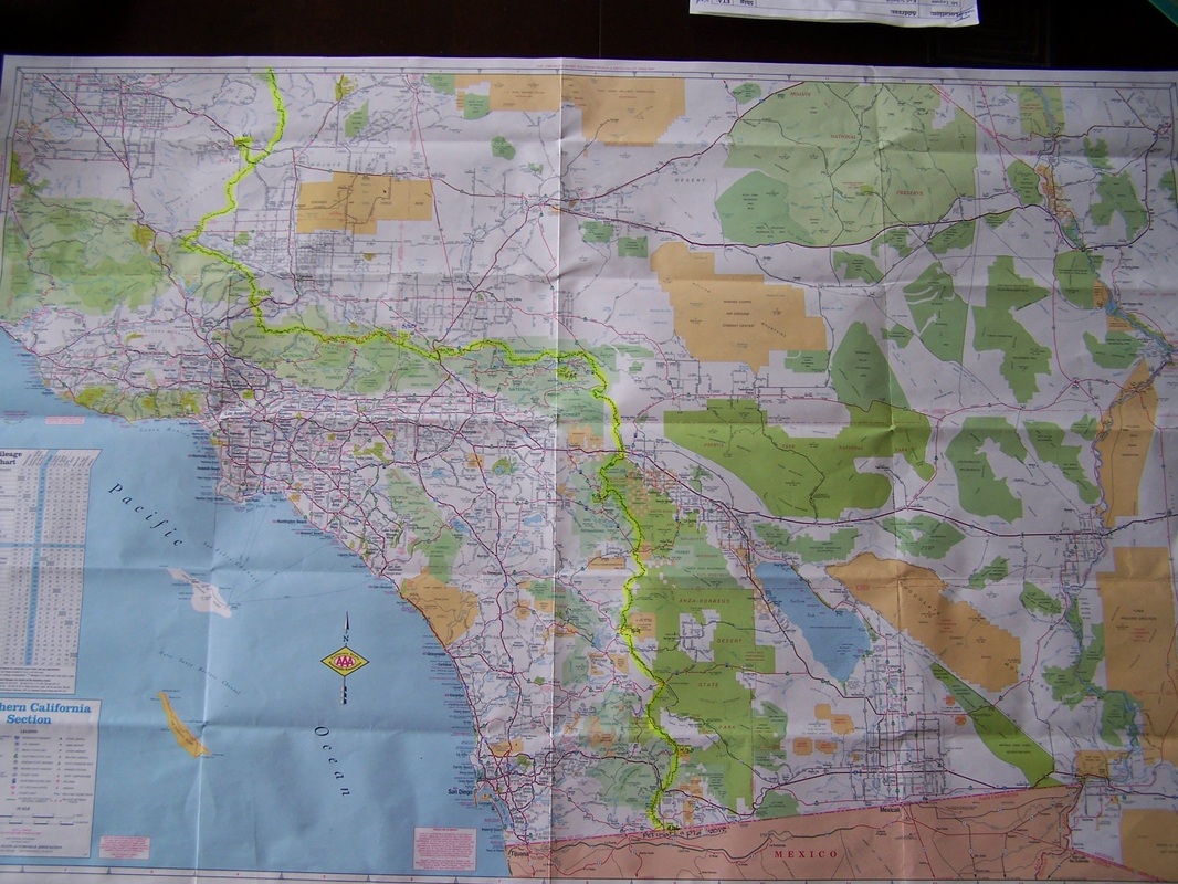
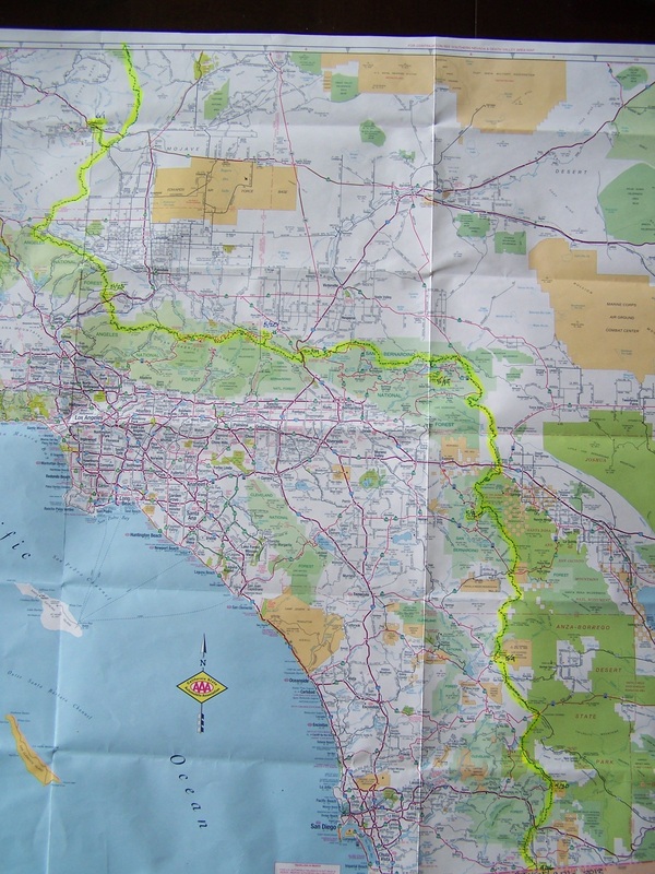
 About the end of the day today Histo-Karl will be off the map! That is the AAA Southern California map. Next map is Southern Nevada-Death Valley.
His shoes did NOT arrive at the Tehachapi PO so he is hiking an extra 140 miles, to Kennedy Meadows, with toes at the tip--hope they hold out (or he may hole-out the end of the shoe).
Another version of the map is shown below--it's a pretty impressive arm-chair adventure, though nothing compared to the amazing experience on the trail.
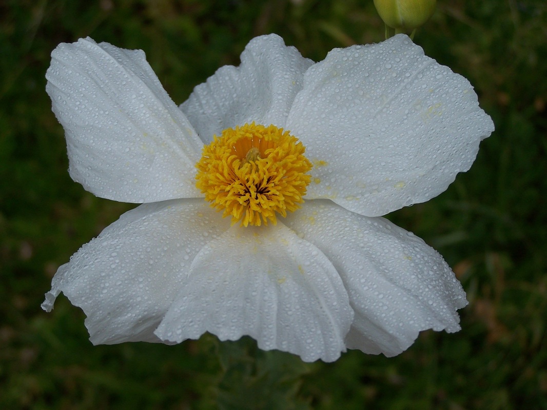
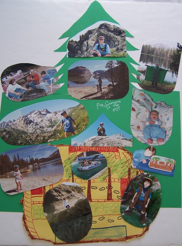
Also for fun a matilleja poppy from home, and the secret behind Histo's success--his nature-loving childhood:
Now that we are 500 miles old as thru-hikers you might think this is getting easier, but the trail always has something up its sleeve. Thursday morning we hit the trail at 3:00 am to cross the Mojave desert. Isn't this the Pacific "Crest" Trail? Well, supposedly congress tried to wrestle with massive Tejon Ranch to follow the mountains but did not succeed so the trail follows the Los Angeles Aquaduct through the Western portion of the Mojave desert for ~15 miles.
With the stars above and the wind blowing strong we hiked through Sunrise among Joshua trees and little else. The flat miles went quickly but the heat was intense. By 9:30 am Peels and I reached Cottonwood creekbed where the aquaduct passes is built up like a bridge. It was easily already over 90 degrees and the wind had died completely by 5am. So as the heat intensified hikers rolled in to follow the shade of the bridge through the day. Eight hot hours later we hiked on through enormous wind turbines recently built but not yet opperational. The heated desert floor very consistently draws in the wind and we had to fight a headwind that kicked up in the afternoon.
Sleep being a lower priority than making miles in comfortable morning hours we were on the trail the next morning at 4am to make our way into Tehachapi. Tehachapi is a great little town. We spent yesterday afternoon sleeping, eating and doing laundry. I had a cream puff the size of a hamburger and we ate amzing BBQ for dinner. Today I pick up some new shoes and seven days worth of food.
From Tehachapi Pass we slowly climb into the Sierra Nevada. I have just one more week of hot, dry desert hiking before reaching Kennedy Meadows, the Thru-hiker gateway to the High Sierra that is a highlight of this hike. We are all dreaming of cold flowing water and high mountain lakes, cooler temperatures and grand vistas. Hopefuly without too many mosquitos.
|
 RSS Feed